
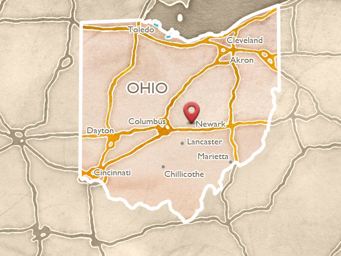
Newark
 ABOUT THE SITE
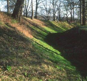
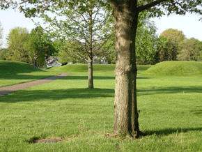
Seventeen centuries ago, Newark, Ohio, was a major center for a remarkable ancient culture. Here, American Indians built the largest geometric earthwork complex in the world. Enormous enclosures connected by walled roadways were spread across more than four square miles. This was the most spectacular of many such earthworks, concentrated along the tributaries of the Ohio River, marking the people’s beliefs, rituals, and sense of community. Today only fragments remain, although here at Newark we can still walk among these vast shapes, and feel how they direct our eyes and footsteps.
Two of the most impressive features from ancient Newark remain today – the Octagon and Great Circle – helping visitors grasp the literally unbelievable scope, beauty, and precision of this unique architecture. Awed settlers discovered, described, and began to measure it in the early 1800s. The impact of these monuments on the visitor today is still stunning, creating an architectural experience like no other on earth.
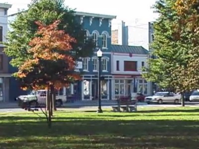
Begin your tour of Newark at the well-preserved Courthouse Square. The history of the town and its industrial heritage is well told at the nearby Works Museum, where there are more shops and artists’ studios (55 S. 1st St., 740 349-9277).
From downtown Newark, take Main Street west, then turn south on Route 79 for 1½ miles to the Great Circle Earthworks on the right. The small museum and visitors center, a short walk from the parking lot, will provide an orientation to the whole complex and its history; a bronze tabletop model stands out front.
Play video

Play video
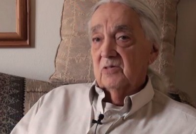
Eastern Shawnee Chief Glenna Wallace describes returning to Ohio, and discovering the Newark earthworks.
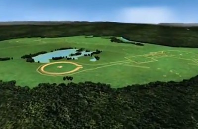
The view out across the Newark Earthworks from the Heath Hilltop enclosure, as it may have appeared in antiquity.
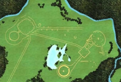
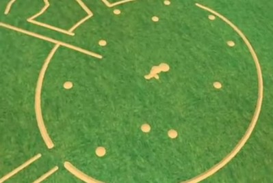
 THE GREAT CIRCLE
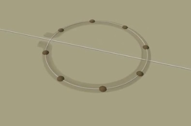
The Museum’s entrance directly faces the monumental gateway of the Great Circle enclosure. This may be the best preserved of the geometric earthworks not just in Newark, but anywhere in Ohio. It’s a gigantic circular enclosure, 1200 feet from crest to crest. Four football fields would fit across it end to end. The walls vary in height from 4 feet up to 14 at the monumental gateway.
The design is typical of many earlier, Adena earthworks: a ring, with an interior ditch and a gateway opening to the east. But here, people coming from other parts of the complex would enter the most dramatic portal anywhere in their cultural world: a sign preparing them for the ceremonies at the circle’s heart.
The Great Circle Gateway, seen from the Museum, Eagle Mound in the center distance. Photo by Tim Black.
 BUILDING THE GREAT CIRCLE
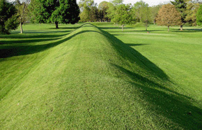
Follow the inner ditch and notice the subtle gradations in the height and steepness of the wall. An excavation through the Great Circle wall has shown how the construction was done. First a set of point mounds were placed around in a circle. Then a ditch was dug, and that soil was used to make a ring. Finally, yellow gravelly clay was brought up from deep pits nearby, to cover the inside.
Building techniques probably had both spiritual and practical meaning: The yellow clay smoothed and supported the inner wall, but the color also made for a more dramatic ritual space. The ditch provided earth for the wall, but it also may have filled with water in wet seasons, presenting a second, magical circle.
Building the Newark complex 2000 years ago, they had to move more than 7 million cubic feet of earth. It would have taken many generations, or an enormous number of workers. Archaeologist Brad Lepper:
They were built with pointed digging sticks and perhaps hoes or picks, made with a deer shoulder blade, and hafted onto a stick – simple tools. The Hopewell people used this to dig pits in the ground and then fill the earth… in baskets and carry those baskets one at a time to mound them one after another.
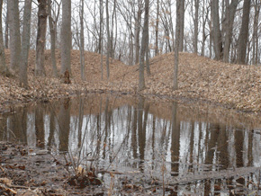
 THE WATER-FILLED DITCH
New evidence suggests that the Great Circle’s ditch was designed to hold water; ancient ditches and ponds at some other earthworks still do. Dr. Brad Lepper suggests what this may have meant:
I think it was intended to evoke in some way, or presence in some way, that watery underworld of Native American traditions: the Beneath World. And whether it’s in the form of a spirit barrier, or whether it’s just simply to have that presence of water surrounding the ceremonies… that’s probably as close as we can come to understanding the purpose now.
The ancient clay and limestone lining of the ditch probably held water for centuries, but in the long run would have required maintenance. This explains why we don’t see water in it today:
Over the centuries, as roots penetrate that, the seal is penetrated. And the Newark Earthworks are built on hundreds of feet of glacial sand and gravel. So you could be pouring water into that all day, and unless it was sealed that water would just vanish.
The Great Circle’s inner ditch was originally constructed to hold water, making a continuous reflecting pool or “spirit barrier”.
 EAGLE MOUND
At the center of the circle is an elegantly undulating earthen memorial built over the remains of a long, timber-framed building with two “wings.” This mound was nicknamed “Eagle Mound” by the first pioneers. When it was excavated in 1928, a pattern of postmolds showed a long building, with screen-walls extending from it like two wings.
Inside, a rectangular clay basin held fires, a sign of ritual activity. Scraps of shiny mica littered one end of the floor. When they were finished using the building, the people filled the fire basin with white sand and left little behind except a pair of copper shapes. They dismantled the wooden structure or burned it and covered its floor with earth. As often in this culture, such ritual mounding created a final, sacred memorial to the structure’s meaning.
 PROCESSIONAL WAYS
Outside the Great Circle gateway and to the north and east are well-preserved remains of the low embankment walls that once encircled the entire Newark complex with a continuous outline. There seem to be only three entry points, all of them suggesting ceremonial approaches from water. Once inside, the people were channeled from one specialized enclosure to another. Archaeologist Brad Lepper:
I think you could almost view the elements, the different functionally specialized yet integrated elements of this site as components of a gigantic ritual machine. And movement through that site, you know, would have been a way of power flowing through that; or the people moving through it, the pilgrims, the priests, the shamans, moving through that site, would in some ways be re-enacting some fundamental, cosmological cycles.
Dance and procession on specialized ceremonial grounds remain important features of American Indian rituals today.
Low earthen walls encircle the entire complex and seem to channel movement from one geometric figure to the next.
 NEWARK'S WATERWAYS
If we follow the logic of these low walls enclosing the entire complex, we’re left with only three “entrances” where people could have entered without climbing over them – all from waterways. It seems the builders chose a site surrounded by waterways, and centered on a pond, and then made its only entrances via water. Yet boats could not go anywhere on at least one of the creeks. Probably, water meant more than just a way to travel. Dr. Lepper:
In the cosmology of many Eastern Woodland tribes, the universe is conceived as three-layered: a sky world, called the above-world; our middle earth on which we live, and a below-world, an underworld, that’s mostly water. And each of these has its spirit powers associated with it. The thunderbirds live in the above-world. The Great Serpent and the Underwater Panther live in the underworld, the watery world. And I think the sources of water are places where the underworld makes contact with this world.
If this cosmology that we’ve defined from historic Native Americans can be projected back 2000 years, or at least elements of it, then the watery underworld, the beneath-world, forms a very important source of spiritual power that generates some if not all of the power behind this site.
The best-preserved examples of Hopewell-era water architecture are the ponds just inside the walls at Fort Ancient.
 A SACRED REGION
The whole region around the Newark Earthworks was apparently sacred: other earthworks, plus various alignment points are spread throughout the surrounding hills. Across the Licking River, an earthen square 740 feet on a side was attached to a ring and ditch (now lost). Atop a steep wooded hill (visible from the Great Circle parking lot), a big ring with a central mound still stands. Archaeologist Brad Lepper:
There are other mounds and earthworks on many hilltops that surround this area. I think they all somehow relate to a continuous pattern of land use that felt the land was sacred, that added these architectural fixtures to it, that in their minds perhaps only increased the sacredness of it, and channeled it, and put it into these earthen vessels and channeled it down these parallel corridors.
 THE "OLD FORT"
From its first discovery by Europeans, and its initial naming as the “Old Fort,” the Great Circle has been preserved, and renamed, through uses both recreational and military. Historian Jeff Gill explains:
We also have the early pioneer history interacting with the structure, calling it the “Old Fort.” (But around 1820) Caleb Atwater comes along and he starts to notice: Wait a minute, the moat’s on the inside of the wall, maybe it’s not a fort. But the name changes largely because, shortly after that, it becomes the County Fairground – and it becomes known as the Fairgrounds Circle.
Later, local area soldiers gathered and trained here on their way to fight in the Civil War:
And the “76” fights all the way down to Atlanta, and to Savannah, and then up for the grand review in Washington at the end of the war, and back home. And of the 900 men who left, less than half make it back home.
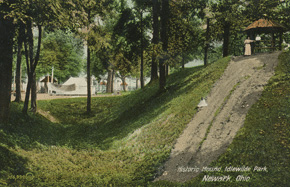
The so-called “Old Fort” (The Great Circle) became the Licking County Fairgrounds, and was also knwn for a time as “Idlewilde Park”.
 PUBLIC SPECTACLES
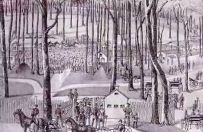
Spectacles and Encampments continued in the later nineteenth century, and into the twentieth, including Buffalo Bill’s Wild West Show (complete with Indians). Jeff Gill:
Can you imagine, thousands of Licking Countians sitting on those walls, and Buffalo Bill himself and his whole crew coming in and out of that gateway? Buffalo Bill said it was the most amazing place he ever did the show – as compared to your standard fairgrounds or arena. What a sight!
Dr. Lepper tells the story of another grand spectacle at the “Fairgrounds Circle” that almost ended in disaster! It was the 1874 Grand Reunion of the soldiers and sailors that served from Ohio in the Union Army:
President Hayes was a guest. Future President General James Garfield was there. William Tecumseh Sherman was there. And a speaker’s platform was erected across from the big grandstand where the people would watch the race. Partway through the program it began to collapse, and the paper says that President Hays, and General Sherman, and Garfield, only saved themselves by throwing themselves forward out of their chairs, while the chairs fell backward into the collapsing ruins. So Newark almost became famous for losing a president.
 A PRAIRIE LANDSCAPE
Most of Ohio was covered by mature oak-hickory forests in antiquity, and up to the time to settlement. But we also know that vast prairie openings were also here: either naturally or maintained by humans. They were probably an essential feature of earthwork sites. Dr. Brad Lepper explains:
There was a well-developed prairie soil beneath what most people think was the earliest element in the Newark Earthworks, the Great Circle. I believe the prairie had been there for hundreds of years, perhaps thousands of years prior to the Hopewell building it. Hunting and gathering peoples all over the world burn off sections of forest and maintain them artificially as prairies. In a fully mature oak-hickory forest there aren’t very many deer, so they would burn off sections of forest and keep them burned off to maintain it as a prairie, to cultivate the ground for the purposes of keeping high densities of game.
 THE CHERRY VALLEY
When the first pioneers came to the area around the Newark Earthworks, they found huge numbers of mature cherry trees. Within a few generations they were all harvested and sent to Cincinnati to be turned into furniture. But Brad Lepper speculates on how this “cherry valley” came to be here:
I think it’s entirely likely that cherry trees may have been artificially planted and grown, for the people coming to the earthworks for festivals, because they liked cherries, and maybe that was part of the foods that were consumed here. The profusion of cherry trees in the historic times may be the remnants of those groves that were here indigenously.
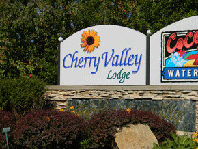
The name "Cherry Valley" is all over this area, on malls, roads, and businesses; though it may originate in deep antiquity.
 THE SALISBURY BROTHERS
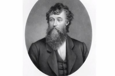
Two brothers named Salisbury made the most precise and detailed map of the Newark Earthworks. That map, along with its detailed descriptions, became the basis for the computer visualizations in all our Ancient Ohio Trail materials. Brad Lepper explains who the brothers were:
James and Charles Salisbury were interesting. Dr. James Salisbury was a physician, who practiced in Newark. He was wildly famous and popular for having a fad diet called the Salisbury Diet: many of his patients were former veterans of the Civil War who’d subsisted on a steady diet of hard-tack and coffee, and their digestive systems had been ravaged. And so he invented Salisbury Steak as sort of a easily digestible form of diet for them. But (he was) a dedicated antiquarian, and many of the dedicated antiquarians were physicians, for one reason or another. And the Salisbury map is quite accurate: you can overlay the Salisbury map over the aerial photographs we have and it matches precisely.
 MODERN RITUALS
Thanks to the efforts of the Newark Earthworks Center the Great Circle is seeing a return of Native rituals and events. As part of Newark Earthworks Day 2008, after scholars compared the site with Stonehenge and with Teotihuacan in Mexico, the crowds adjourned to a ceremonial dance here. Dr. Dick Shiels tells the story:
We brought ten people from Mexico who are Aztec descedents, and who as a part of their own personal spirituality dance and perform Aztec dances in costume. We went to the Great Circle. And the Aztec dancers led us into that circle and preformed a dance in the middle of it. We think there were roughly 500 of us there when it began to rain. And perhaps a hundred of us stayed through the rain; we got absolutely drenched. But it stopped raining, and the sun came out, and the dancing went on, and we dried off, and it was wonderful. And when it was done the dancers told me: “It was a rain dance.”
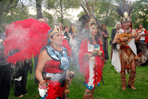
In 2008, dancers of Aztec ancestry performed for Newark Earthworks Day audiences inside the Great Circle Earthwork. Photo by Tim Black.
 THE SQUARE
A few blocks away lies a fragment of Newark’s ancient earthen square, the Wright Earthworks, at Grant St. near James, viewable from James St. (accessible via 21st Street; drive around the Great Circle and head north). The Square was originally about the size of nine city blocks. Eight small mounds inside its gateways emphasized its geometric precision. Much of the square and the surrounding lines were destroyed, some as early as the 1820s, when the Ohio Canal was cut through here. Less than 20 years later, Squier and Davis reported:
The ancient lines can now be traced only at intervals, among gardens and outhouses... A few years hence, the residents upon this spot will be compelled to resort to this map, to ascertain the character of the works which occupied the very ground upon which they stand.
Play video
Play video
Miami Tribe official Julie Olds talks about why preservation of sites like this is important to Native people.
 THE BURIAL ELLIPSE
From the Square, the view to the water tower to the northeast will help in grasping the scale of the earthwork complex as a whole: it stands near the center of the giant Ellipse. Each piece of the Newark complex seems to have had a special use and meaning, and this Ellipse was the cemetery of the earthwork’s builders – a necropolis probably as grand as Mound City in Chillicothe. Eleven conical mounds surrounded a large, irregular one at the center. One set of burials here was covered in sheets of gleaming mica. Some of these mounds were probably already very old before being surrounded by the elliptical wall: perhaps adding this new order was another way to honor the ancestors.
The ellipse and its mounded tombs were destroyed very early by the construction of the canal and the railroads, and the growth of the town. Old records prove that builders and looters came across objects made of copper and other precious materials. Yet today, the only thing we know came from this area is the extraordinary “Shaman of Newark.”
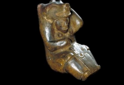
 THE NEWARK SHAMAN
The Shaman of Newark is a fist-sized stone figurine of a man in a bearskin. He’s holding a human head in his lap, and may be preparing it for burning or burial, or using it for divination. Archaeologist Brad Lepper:
He’s dressed as a bear, a bear’s head on his head, bear claws on his hands, he’s wearing ear spools, and in his lap he’s holding what appears to be a decapitated human head wearing the same style of ear spools. One of the most fascinating things about this is the depiction of a shaman apparently in the very act of transforming into an animal spirit: the hand… on the head appears to be either in the act of lowering the mask on his face or perhaps raising it above his face. In fact if… you’re talking about the shaman’s transformation, and simply tilt it, the shaman transforms before your very eyes!
The bear has traditionally meant many things to native people, including awakening after a long hibernation. Sending someone to their burial with such a symbol of rebirth would link them to the renewing circle of life.
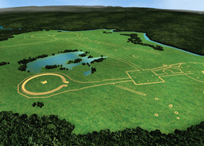
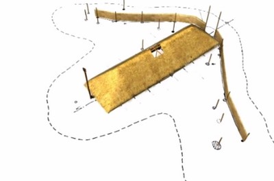
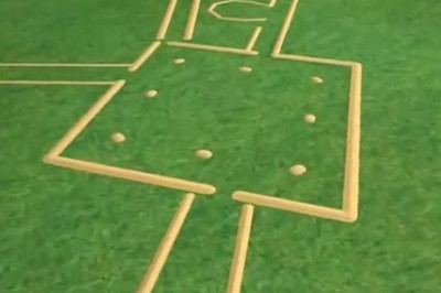
 THE OCTAGON EARTHWORKS
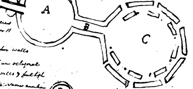
Across town from the Great Circle (once linked by ancient walled roadways, now by 21st Street, Main Street, and 33rd Street) the precise Octagon Earthworks present their perfectly level artificial horizons, used in antiquity to mark the complex movements of the moon. A giant circle connects via an avenue with the even larger octagon, with cleverly designed corner gateways. Small earthen walls nearby were the beginning of a long straight roadway to the southwest.
Arriving at the parking lot of the Moundbuilders Country Club, you are at the heart of the Octagon Earthworks. A small wooden platform has been built here to offer an orientation, and views into the Avenue connecting the giant Observatory Circle (on the left) with the open-cornered Octagon (on the right). This octagon and its adjoining circle are the most precise of all the remaining earthworks. They’re a half-mile across, perfectly formed, and exactly level. The circle’s diameter is 1,054 feet, an interval that also perfectly constructs the Octagon (as the sides of a diagonal square it perfectly touches 4 gateways).
Throughout the site, the walls are just at eye-level, keeping us enclosed, and forming an artificial horizon. Even the gateways are visually blocked by these smaller mounds. Inside this huge, perfect work of geometry, our eyes are drawn across from one point to another, and on to the real horizon beyond. Poles and banners probably marked the gateways. We can imagine grand processions along the wide roadways, moving among the various parts of the complex.
Play video
Avenue and gateway of the Octagon as seen from the Ohio Historical Society's elevated viewing platform.
Precision of one of the walls of the Octagon, viewing toward the edge of the terrace above Raccoon Creek.
 A LUNAR CALENDAR
The lunar alignments at Newark were just discovered a few decades ago. Two professors from Earlham College went looking for solar alignments at the Octagon, and initially with skepticism. Ray Hively is an astronomer, and Bob Horn is a philosopher:
So we surveyed the major symmetry axes, we surveyed the lines along the earthen walls, the lines between vertices and mounds, and I thought, well, we’ll get a bunch of alignments to the solstice points from this. And the first shocking fact was that, in spite of some claims to the contrary, there were NO solar alignments at Newark. And that’s when I was shocked to find that the major symmetry axes of the circle-octagon combination, as well as 4 of the 8 walls, all align very precisely with extreme rise and set points of the moon, which illustrated very nicely the 18.6 year cycle in the motion of those extreme rise and set points.
Dr. Hively reflects on the significance of the fact that people living here so long ago could create such huge monuments with such precise links to the movements of the heavens:
I think that the accomplishment at Newark is great for a number of reasons. Of course, the physical scale and precision of it is a great accomplishment, but the fact that this structure simultaneously encodes geometrical and astronomical information is an astounding and highly motivating discovery for any society that makes it.
Even today, modern physicists are motivated in a sense by the same kind of dual desire: that is, the desire, the passion, in fact, to find a correspondence between mathematical symmetry and natural phenomena. That is a very powerful discovery, and I think that we’re dealing with something like that here.
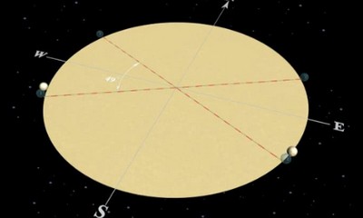
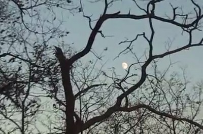
The precise geometry of Newark’s circle-octagon centers on its axial center line, beginning at the center of the Observatory Mound and pointing 38 degrees north of east. It’s a long line of sight which, if the site were cleared of trees, would lead the eye to a precise point on distant horizon. From here, as a result of generations of careful measurements and designing, the ancients could predict, and bear witness to, the return of the moon to its northernmost position – just once in every generation.
The movements of the moon are complex. Nowadays, we notice that the moon has different phases over about 29 days. But the builders of the earthworks noticed much more complicated lunar patterns: first, about every four weeks its rising point swings back and forth between the southeast and the northeast; and second, the width of this angle expands very slowly over about 9 1/3 years, and then contracts again at the same rate. The moon’s setting points move the same way across the western horizon.
So there are eight points where the moon appears to reverse direction along the horizon during this long, complex cycle. Remarkably, all eight are marked precisely by these earthen walls and gateways. The architecture here tells us which one mattered the most: the extreme northernmost moonrise perfectly aligns along the central axis of the Octagon. This happened only once in 18.6 years. It must have been their grandest and most sacred festival.
Play video
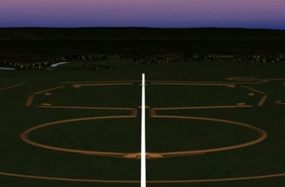
The moonrise and moonset positions move along the horizon in a very complex, 18.6-year-long cycle.
Reconstruction of the axial moonrise experience, every 18.6 years, and seen from above the Observatory Mound.
 MODERN MOONRISE CELEBRATIONS
Hively and Horn’s discoveries about the Octagon’s alignments were first published in the 1980s. Brad Lepper and Jeff Gill were soon calculating when the 18.6-year cycle would bring the moonrise back to its perfect axial position. Historian Gill explains:
We were looking at getting to be the first people in 1500 years to go and watch something happen in a place and in a way that it was originally intended to do…. And so there we stood, on the central alignment, and looking along where those walls said to us, whispered across the centuries: “There it will happen.” And when it did, it was just one of the most memorable moments of my life…. And, you know, that’s the kind of stuff that you get involved in archaeology to do, which is to just reach across the centuries and have that human contact.
Now that the moonrise alignments have been re-discovered here, there have been increasing numbers of celebrations. A group of Native Americans came for the 2005 maximum moonrise, and went out into the Octagon. Dick Shiels recalls:
We got to the site and there was this mist: you couldn’t see the walls of the earthworks, let alone the moon. But we had brought a Lakota spiritual leader from South Dakota, who led us in. We had brought Native singers from around the state who led us in. We walked into the center of the octagon. The Native leader sang and prayed, we stood there in the mist unable to see anything at all for about a half an hour, and as we walked back I saw 50-year-old college professors with tears running down their faces. It was a tremendously moving experience. Those of us who have been planning these things have learned a great deal, we’ve learned to appreciate how fully these sites are Native sites, and so we have included more Native speakers, and more of a Native perspective…
Play video
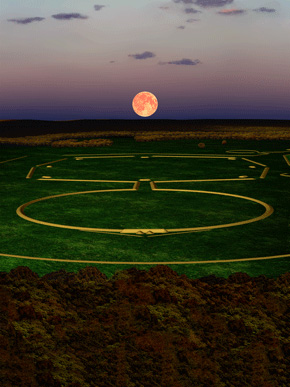
Witness the full moon rising over the central axis of the Octagon’s perfect geometry.
Play video
In modern Native traditions the moon is central to timekeeping and ceremonies, and is often understood as female.
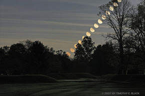
Tim Black’s time-lapse photograph of the moon rising above the Avenue, between the Observatory Circle and Octagon.
 OBSERVATORY MOUND AND CIRCLE
The once-in-a-generation moonrise alignment explains the position of Observatory Mound, at the end of the main axis. Yet it sits atop a most unusual and elegant detail. The sides of the large circle don’t quite meet, instead curving gently inward and underneath the mound; they emerge on the outside as two small twin tails (today’s exact configuration is a 19th century partial reconstruction). Dr. Brad Lepper explains:
It appears as if there used to be an entrance that went into the circle, so just like the entrance to the Great Circle it ends in sort of these gateway forms of two tails. An entrance way just like that, I think, originally existed outside of the circle, and at some point the builders chose to block that entrance off by building what we call now “Observatory Mound” across that entrance. So the architectural configuration we see today is a former entrance way, blocked off by a large mound.
Continuing around or through the northern half of the circle towards the far, left flank of the Octagon, there are views across the circle’s interior that emphasize its remarkable precision as an “artificial horizon” and sighting instrument. Its 1,054-foot diameter is so great, and its form so subtle, that it’s possible to nearly lose the feeling of being within such a precisely enclosed space.
The twin tails behind Observatory Mound suggested to Atwater there might be an arched passageway beneath the mound.
 RIVER TERRACES
From the far, northernmost sides of the Octagon, there are clear views of the natural terraces down to Raccoon Creek. The geometric earthworks of the Ohio Valley region were always built on these high, second terraces above the rivers, where there were perfectly level surfaces plus deep, gravelly soils for good drainage. Dr. Brad Lepper:
The earthwork is up on this very, very high terrace, and it’s very, very near the edge. And there are some borrow pits of earth located nearby. There’s one over by the Country Club building. But it seems to be a very obvious and easy place to have gotten the earth was from that cliff face: rather than trying to dig a hole with a digging stick or a clamshell hoe, simply putting your stick into the ground and carving off the side of the bluff into the baskets, may have been one of the most important sources of earth for constructing the earthworks.
 THE OCTAGON GATEWAYS
The distance across the Octagon is even greater than that of the Observatory Circle: views from one gateway to its opposite are nearly lost, especially when the air is hazy. Yet sighting along these walls, and point to point across the geometric figure, and on to the horizons beyond, was a major function of this place. At the Octagon’s cleverly-designed gateways, the precision of this monumental architecture is at its most apparent: perfect, flat-topped mounds block the vistas out of the Octagon’s open corners. We are both contained and released, with subtle shifts in these effects as we move around inside.
An early, eighteen-sixteen map of the earthworks hints at another possible feature of these eight gateways. A black dot next to each gateway mound was labeled “cavity”. Brad Lepper explains how one of these was excavated, and what was found:
It’s simply a large pit filled with… coarse gravel with a post sitting beside it. And inferring that one of these would be located next to each one of those platform mounds, you can speculate (that)… perhaps they’re different clan entrances, and if you’re bear clan there’d be a big mica symbol of a bear or something attached to that pole. Alternatively, perhaps those were the posts set originally for making the astronomical alignments.
The eastern, somewhat overgrown gateway of the Octagon touches the modern road, near modern houses, raising the question of where Newark’s ancient earthwork builders lived. Recent evidence suggests that people gathered from both local and distant places in very large numbers, first to build and then to use the site. Vast temporary villages or encampments may have covered much of the surrounding land.
Fragment of the Campbell-Walsh Map of 1816, showing evidence of post holes adjacent to each gateway mound.
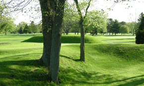
The walls of the Octagon with one of the gateway mounds; from certain angles our eye is prevented from escaping the enclosure.
A conjectural reconstruction showing clusters of houses and village fires near (but never inside of) the geometric earthworks.
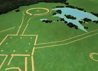
 GEOMETRICAL PRECISION
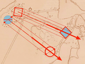
Ellipses, squares, octagons, circles, parallel walls: The builders of ancient, monumental Newark clearly knew how to lay out huge geometric shapes with great precision. These different figures used common dimensions. The diameter of the Observatory Circle forms a square inscribed in the Octagon. Laid out six times, it marks the distance to the Great Circle, or that from the Octagon to the Square.
Parallel lines would connect the corners of the square with those of the Octagon, more than a mile away. Another set would connect the main axis points of the two large circles. Incredibly, these two sets of imaginary parallels mark the minimum and maximum southern moonrises. There are also matched circumferences, and areas. These startling relationships show that somehow, there’s a larger, unifying idea – it’s not just a haphazard or incremental arrangement.
The High Bank earthwork near Chillicothe is the only other Circle-Octagon; its central axis is at 90 degrees from Newark’s.
Play video
The design of the overall Newark complex was not haphazard, but contained precise mathematical relationships and alignments.

Play video
Eastern Shawnee Chief Glenna Wallace speaks of the complexity of the Newark earthworks.
 THE GREAT HOPEWELL ROAD
The southern gateway of the Octagon opens to a small stretch of grass and an exquisite small circular enclosure. This is one of many that accompanied the Newark Earthworks as recorded on 19th century plans.
The remnants of low embankments just past the small circle the beginnings of a long straight roadway that took off to the southwest. Early maps show it as consisting of perfectly straight parallel lines, about 180 feet apart and about 3 feet high, extending for at least six miles. If it continued at this angle for sixty miles, as Dr. Bradley Lepper has suggested is possible, this monumental highway (now termed the “Great Hopewell Road”) would have arrived at Chillicothe, where we find more earthwork complexes with similar features, including the only other circle-octagon, High Bank Earthworks. Southwest of Newark, the lines that the early pioneers could trace through the forests and over the streams were plowed under or bulldozed away long ago. Perhaps this was a road of pilgrimage, carrying great processions, between two of the greatest Hopewell ritual centers.
Dr. Lepper had studied the long straight roads of the ancient American Southwest, before coming to Newark, so he was especially intrigued when he found this remarkable feature on a never-published map of the Newark Earthworks, drawn by James and Charles Salisbury in 1862.
They certainly did a very comprehensive survey of everything that was extant. They show the outer wall around the Octagon, which nobody else but Wyrick showed. And also they pointed out that the parallel walls that came out of the Octagon went much farther than Squier and Davis had said. Caleb Atwater thought those walls might go 30 miles. The Salisburys say that they followed those walls two and a half miles and came to Ramp Creek. But they crossed Ramp Creek, (and) said that the walls continued for six miles, through tangled swamps and over hills, still “keeping their undeviating course.” So that’s where my work on the Great Hopewell Road really began.
Since Dr. Lepper’s discoveries in the 1990s, the “Great Hopewell Road” idea has captured the public imagination. But whether it really existed, as we want to imagine it, can now probably never be confirmed.
It depends on how we define the “Great Hopewell Road.” If we define it as a pair of parallel walls that extended for 60 miles from Newark to Chillicothe, then it’s premature for the public or anyone else to accept that claim. If we define the “Great Hopewell Road” as a corridor, a straight corridor connecting Newark and Chillicothe framed at least part of the way, coming from Newark southwestward, by parallel walls, then I think the “Great Hopewell Road” for a certainty existed.
With such an ancient ceremonial roadway, Newark might have been one of the most important destinations in all of North America. People brought exotic materials here from far away, like mica, obsidian, and copper. Maybe they were trading at a vast Newark marketplace for the local Flint Ridge flint. Yet only tiny bits of Ohio flint have been found at the origin points of those precious things. Dr. Lepper offers an explanation:
This was like Jerusalem or Santiago de Compostella. It was a place where people came from miles around, like Mecca. It was a place of pilgrimage, and people were coming here bringing offerings, offerings of thanksgiving for a healing, offerings in the hope of a blessing of some sort. And what they took back with them from their pilgrimage was that spiritual power that was imparted to them at the site, and also perhaps a pilgrim’s token, a souvenir, some badge that says “I’ve been on the Great Haj to Newark.”
Play video
Brad Lepper explains his discovery of the Great Hopewell Road.
Play video
The nearby Flint Ridge quarries may help explain how Newark became such an important destination in antiquity.

Play video
A modern “Walk with the Ancients” along the Great Hopewell Road route begins with traditional Native smudging with smoke.
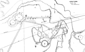
The Salisbury Map was found by Dr. Lepper in the archives of the American Antiquarian Society in Worcester, Massachusetts.
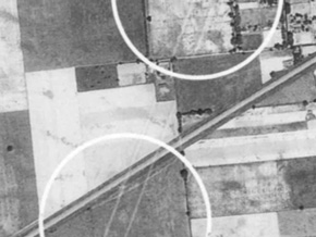
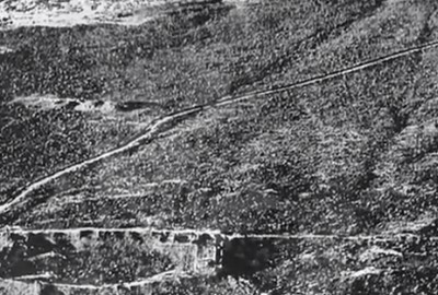
Aerial photos from the 1930s by Dasch Reeves show the walls of the “Great Hopewell Road” in fields southwest of Newark.
 THE OCTAGON'S MODERN HISTORY
When pioneers began to settle around Newark in the late 1700s, the earthworks were already ancient and overgrown. Local Indians, many just recently arrived in Ohio themselves, knew or told little about them. From the beginning, the mystery and size of the works fascinated some Newark citizens and visitors, but many people only wanted to loot the mounds, or cut them down to build houses or factories.
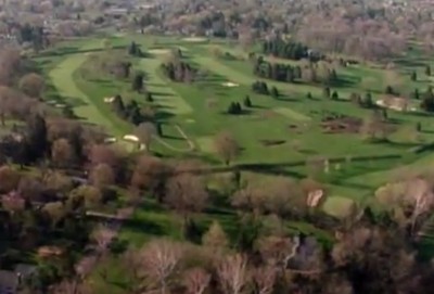
The only reason two major parts of the earthworks survived is that they were adaptable to entertainment: The Great Circle became the Licking County Fairground from 1854 to 1933. The Ohio State Militia encamped at the Circle and Octagon for a few years around 1900, and the land was leased as a private golf course by 1910.
Barbara Crandell, a woman of Cherokee heritage, was arrested in 2002 when she went to pray at the Observatory Mound during golf play. She explains why she was willing to risk arrest, the ancestral connection she feels to the earthworks:
They built these things so we would remember who we are. Don’t lose track of who you are! When I go to the mounds, I feel a great welling up of pride and love for my people. I love my ancestors. I love their bones. That’s the way I was brought up. I have great reverence for them. And every one of those mounds, I know their hands lovingly gathered the dirt, and put it there. And I can feel their hands patting me, when I go there. So that’s why I think it was left as a trail for native people to follow. Go there and connect with your ancestors, so you can walk a good path. It is terrible that people are not allowed to go to these places. I mean, they’re not just for Indian people. I mean, I connect with them, maybe in a different way. But all peoples should be able to go there. They should be able to go there and see this wonderful sight. And I’d like to have it open for everybody.